Red Line du métro de Washington


Cet article est une ébauche concernant une ligne de métro et Washington.
Vous pouvez partager vos connaissances en l’améliorant (comment ?) selon les recommandations des projets correspondants.
| Red Line (RD) | ||
| ||
| Réseau | Métro de Washington | |
|---|---|---|
| Histoire | ||
| Mise en service | ||
| Exploitant | WMATA (en) | |
| Infrastructure | ||
| Conduite (système) | Conducteur | |
| Écartement des rails | 1,429 mm | |
| Électrification | Troisième rail (750 V CC) | |
| Exploitation | ||
| Points d’arrêt | 27 | |
| Longueur | 51,3 km | |
| Jours de fonctionnement | L, Ma, Me, J, V, S, D | |
| Lignes connexes |      | |
modifier  | ||
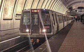

La Red Line (RD) est l'une des six lignes du métro de Washington.
Plan de la ligne

Plan de la Red Line du métro de Washington.
Historique
Chronologie
- , ouverture de Farragut North à Rhode Island Avenue 6,8 km[1],
Histoire

Cette section est vide, insuffisamment détaillée ou incomplète. Votre aide est la bienvenue ! Comment faire ?
Infrastructure
Ligne
Cette section est vide, insuffisamment détaillée ou incomplète. Votre aide est la bienvenue ! Comment faire ?
Stations
La ligne dispose de 27 stations[2] :
| Station | Type | Situation | Correspondances | |||
|---|---|---|---|---|---|---|
| ■ | Shady Grove | Surface | Maryland | |||
| ■ | Rockville | Surface | Maryland | Trains via la gare de Rockville | ||
| o | Twinbrook | Surface | Maryland | |||
| o | North Bethesda | Surface | Maryland | |||
| o | Grosvenor–Strathmore | Surface | Maryland | |||
| o | Medical Center | Souterraine | Maryland | |||
| o | Bethesda | Souterraine | Maryland | |||
| o | Friendship Heights | Souterraine | Washington DC | |||
| o | Tenleytown–AU | Souterraine | Washington DC | |||
| o | Van Ness–UDC | Souterraine | Washington DC | |||
| o | Cleveland Park | Souterraine | Washington DC | |||
| o | Woodley Park | Souterraine | Washington DC | |||
| o | Dupont Circle | Souterraine | Washington DC | |||
| o | Farragut North | Souterraine | Washington DC | |||
| ■ | Metro Center | Souterraine | Washington DC | | ||
| ■ | Gallery Place-Chinatown | Souterraine | Washington DC | | ||
| o | Judiciary Square | Souterraine | Washington DC | |||
| ■ | Union Station | Souterraine | Washington DC | Trains via la gare de Washington Union Station | ||
| o | NoMa–Gallaudet U | Surface | Washington DC | |||
| o | Rhode Island Avenue | Aérienne | Washington DC | |||
| o | Brookland–CUA | Surface | Washington DC | |||
| ■ | Fort Totten | Surface | Washington DC | | ||
| o | Takoma | Surface | Washington DC | |||
| o | Silver Spring | Aérienne | Maryland | |||
| o | Forest Glen | Souterraine | Maryland | |||
| o | Wheaton station | Souterraine | Maryland | |||
| ■ | Glenmont | Souterraine | Maryland |
Exploitation
Cette section est vide, insuffisamment détaillée ou incomplète. Votre aide est la bienvenue ! Comment faire ?
Notes et références
Voir aussi
Sur les autres projets Wikimedia :
- Images de la Red Line du métro de Washington, sur Wikimedia Commons
Articles connexes
Liens externes
- (en) « Stations (red) », sur wmata.com.
- (en) « WMATA Red Line », sur nycsubway.org.
- (en) « Washington DC (metro) », sur urbanrail.net.
v · m Red Line du métro de Washington | ||
|---|---|---|
| Stations |
|  |
 Portail du métro
  Portail du chemin de fer en Amérique du Nord
  Portail de Washington, D.C.
  Portail du Maryland


