St. Albans, Missouri
Unincorporated community in Missouri, U.S.
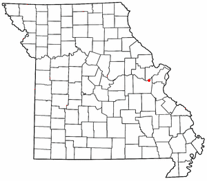

St. Albans is an unincorporated community in northeastern Franklin County, Missouri, United States.[1] It lies approximately five miles northeast of Labadie and about seven miles west of Wildwood. St. Albans is above the Missouri River floodplain. The town borders a small section of St. Charles County which, unlike the rest of the county, lies on the south side of the Missouri River.[2]
St. Albans was founded in 1837.[3] It was named after St Albans, England.[4]
The St. Albans General Store and St. Albans Farms Stone Barn are on the National Register of Historic Places, as is Tavern Cave.[5] The Lewis and Clark Expedition visited that cave and Meriwether Lewis nearly lost his life when slipping down the bluffs here. The expedition journals mention a whirlpool in the river,[citation needed] the Devil's Raceground, which is now dry land, due to a change in the course of the river: it is the portion of St. Charles County anomalously on the south side of the river.
St. Albans was home to The Fulton School at St. Albans, an independent, not-for-profit, private Montessori school serving students from 18 months of age through 12th grade.[citation needed]
References
- ^ U.S. Geological Survey Geographic Names Information System: St. Albans, Missouri
- ^ Missouri Atlas & Gazetteer, Delorme, 1st ed., 1998, p.40 ISBN 0899332242
- ^ "Franklin County Place Names, 1928–1945 (archived)". The State Historical Society of Missouri. Archived from the original on June 24, 2016. Retrieved September 30, 2016.
{{cite web}}: CS1 maint: bot: original URL status unknown (link) - ^ Ramsay, Robert L. (1952). Our Storehouse of Missouri Place Names. University of Missouri Press. p. 29. ISBN 9780826205865.
- ^ "National Register Information System". National Register of Historic Places. National Park Service. July 9, 2010.
- v
- t
- e
Municipalities and communities of Franklin County, Missouri, United States
County seat: Union

communities
- Anaconda
- Beaufort
- Beemont
- Boles
- Campbellton
- Catawissa
- Champion City
- Clover Bottom
- Dissen
- Dundee
- Elmont
- Etlah
- Gildehouse
- Hemker
- Huff
- Jaegers Shop
- Japan
- Jeffriesburg
- Kiel
- Kohl City
- Krakow
- Labadie
- Lonedell
- Luebbering
- Lyon
- Maupin
- Monday
- Moselle
- Mount Hope
- Neier
- Noser Mill
- Oetters
- Piney Park
- Port Hudson
- Robertsville
- St. Albans
- Spring Bluff
- Strain
‡This populated place also has portions in an adjacent county or counties
- Missouri portal
- United States portal
38°34′45″N 90°46′30″W / 38.57917°N 90.77500°W / 38.57917; -90.77500
 | This Franklin County, Missouri state location article is a stub. You can help Wikipedia by expanding it. |
- v
- t
- e


