El Negrito
Municipality of Honduras
15°19′N 87°42′W / 15.317°N 87.700°W / 15.317; -87.700
Municipality in Yoro, Honduras


El Negrito
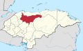
Location in Honduras
 Honduras
 (2023 projection)[1]
El Negrito (Spanish pronunciation: [el neˈɣɾito]) is a town, with an urban population of 13,260 (2023),[2] and a municipality in the department of Yoro, Honduras.
Villages
El Negrito has a total of 29 villages:
- Aldea Paujiles Norte
- Battán
- Campo Perdeíz
- Cerro Prieto No.1
- Cerro Prieto No.2
- El Jocomico
- El Junco
- El Naranjo
- El Negrito
- El Pate
- El Robledal
- El Rodeo
- Estero Indio
- Finca Treinta and Cinco
- Finca Treinta and Seis
- Guangolola 1
- Guangolola 2
- Guaymón No.1
- La Laguna
- La Majada
- La Veinte and Nueve
- La Veinte and Ocho
- Las Delicias
- Nueva San Antonio
- Samar
- San Jerónimo
- San José del Negrito
- Toyos
- Villa del Carmen and Treinta and Siete
Demographics
At the time of the 2013 Honduras census, El Negrito municipality had a population of 45,363. Of these, 95.35% were Mestizo, 3.33% White, 1.03% Indigenous (0.50% Tolupan, 0.19% Lenca, 0.15% Chʼortiʼ, 0.11% Nahua), 0.24% Black or Afro-Honduran and 0.05% others.[3]
References
- v
- t
- e
Capital: Yoro
- Arenal
- El Negrito
- El Progreso
- Jocón
- Morazán
- Olanchito
- Santa Rita
- Sulaco
- Victoria
- Yorito
- Yoro
 | This Honduras location article is a stub. You can help Wikipedia by expanding it. |
- v
- t
- e


